Summary
The Tonga property has significant potential for hosting silver, gold and zinc mineralization and other portions are also molybdenum anomalous. Previous soil, silt and talus fine geochem sampling in the center of the property indicated highly anomalous levels in all of these elements. Drilling in 2006, targeting coincident geochemical and geophysical airborne anomalies, intersected low-grade zinc-silver mineralization but did not explain the molybdenum geochemistry. It is now believed that the geochemical anomaly may be transported, suggesting that the source lies south at higher elevations.
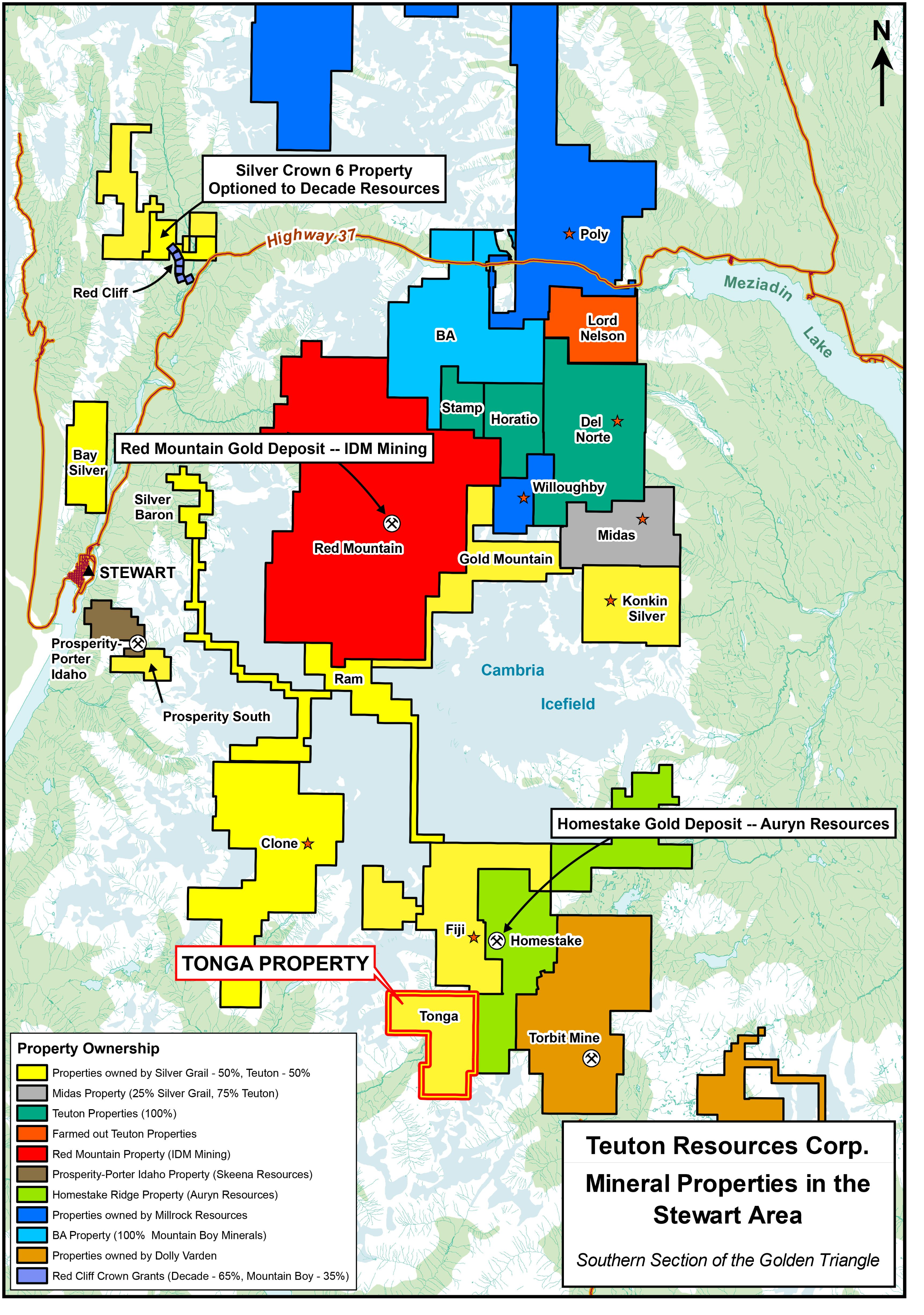
The Tonga property is located 32 kilometres southeast of Stewart, British Columbia, at the headwaters of the O’Neill River and adjoining the Fiji property to the south. Silver Grail Resources Ltd. and Teuton Resources Corp. own the property jointly (50-50).
Mineralization
BC Minister of Mines Annual Reports record that an old prospect called Carpenter’s Claims is situated within the Tonga property boundaries. This prospect was reported to contain free gold in quartz veins mineralized with pyrite and chalcopyrite. During the 1980’s several prospecting traverses were undertaken by various parties aimed both at locating this old prospect and the source of numerous highly anomalous silt geochemical silver anomalies recorded during a 1978 regional B.C. Government survey. One of these traverses led to a discovery of a float boulder assaying 92 oz/ton silver and 1.3 oz/ton gold, however neither the exact location of the old prospect nor the source of the silver geochemical anomalies was ever determined.
In addition, in 2004, a 300 metre long, highly anomalous molybdenum geochemical anomaly was discovered, at the center of the Tonga property. Eleven talus fine samples taken every 30 metres ranged from 111 to 543 ppm moly with an average of 321 ppm. Associated copper, zinc, lead and silver values were also highly anomalous. This work confirmed and extended abundant soil and silt moly geochemical anomalies identified during small programs carried out in 1989 and 1991. Quartz diorite float boulders containing moly rosettes, discovered a few hundred metres north (downstream) in 1982, may be related to this anomalous zone.
The geochemical signature and the local geological setting suggest the possibility that an unmapped “Alice Arm intrusion” may underlie the property. Regionally, these intrusions typically take the form of oval or elongate quartz monzonite to quartz diorite stocks, zoned portions of which host molybdenum mineralization. Quartz veins containing lead, zinc and silver mineralization are also commonly found peripheral to these stocks.